
File:Old town of Tallinn 06-03-2012.jpg
Size of this preview: 800 × 322 pixels. Other resolutions: 320 × 129 pixels | 640 × 257 pixels | 1,024 × 412 pixels | 1,280 × 515 pixels | 2,560 × 1,029 pixels | 7,600 × 3,056 pixels.
Original file (7,600 × 3,056 pixels, file size: 15.49 MB, MIME type: image/jpeg)
Summary
| Description |
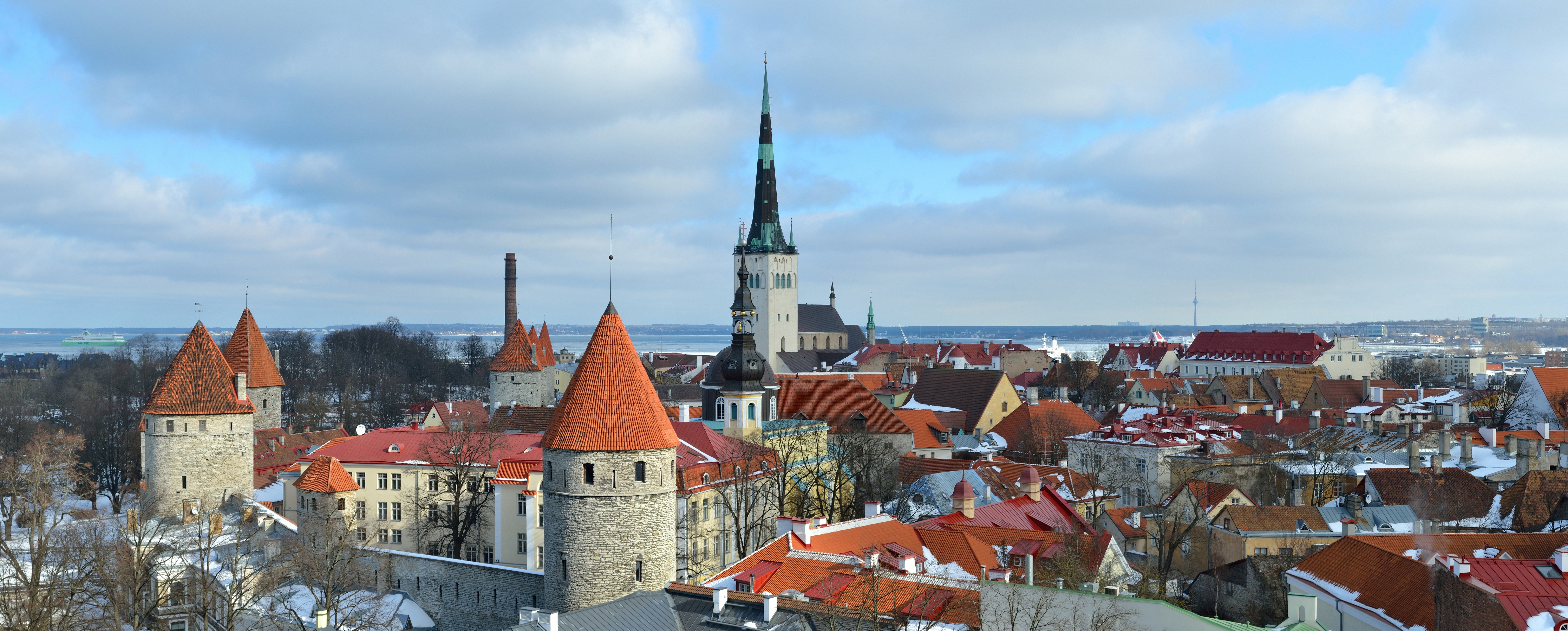
Eesti: Tallinna Vanalinn Patkuli vaateplatvormilt
English: Old Town of Tallinn from Patkuli viewing platform. Includes the city walls
Русский: Вид на Старый Город в Таллине со смотровой площадки Паткуля. Видны крепостные стены
Français : Vue de Tallinn, capitale de l'Estonie, avec notamment les remparts et l'église Saint-Olaf |
| Date | |
| Source | Own work |
| Author | Ivar Leidus (Iifar) |
| Other versions |
| Camera location | | View this and other nearby images on: OpenStreetMap |
|---|
| Camera Model | Nikon D3100 |
|---|---|
| Shutter speed | 1/125; |
| Aperture | f/8; |
| Film speed (ISO) | 100; |
| Focal length | 45 mm; |
| Support | freehand |
| Notes | time 12:15 |
|

|
NOTE: This image is a panorama consisting of multiple frames that were merged or stitched in software. As a result, this image necessarily underwent some form of digital manipulation. These manipulations may include blending, blurring, cloning, and colour and perspective adjustments. As a result of these adjustments, the image content may be slightly different from reality at the points where multiple images were combined. This manipulation is often required due to lens, perspective, and parallax distortions.
|
This image was created with Hugin.
Licensing
I, the copyright holder of this work, hereby publish it under the following license:
This file is licensed under the Creative Commons Attribution-ShareAlike 3.0 Estonia license.
- You are free:
- to share – to copy, distribute and transmit the work
- to remix – to adapt the work
- Under the following conditions:
- attribution – You must give appropriate credit, provide a link to the license, and indicate if changes were made. You may do so in any reasonable manner, but not in any way that suggests the licensor endorses you or your use.
- share alike – If you remix, transform, or build upon the material, you must distribute your contributions under the same or compatible license as the original.

File history
Click on a date/time to view the file as it appeared at that time.
| Date/Time | Thumbnail | Dimensions | User | Comment | |
|---|---|---|---|---|---|
| current | 20:26, 12 March 2012 | 7,600 × 3,056 (15.49 MB) | Iifar | more space to the left side | |
| 18:37, 7 March 2012 |  | 7,072 × 3,100 (13.28 MB) | Iifar | minor changes | |
| 16:48, 6 March 2012 |  | 7,072 × 3,100 (14.19 MB) | Iifar |
File usage
There are no pages that use this file.